It seems like the widget that allowed you to embed Google Earth tours (with audio and motion) online isn’t working. We had at least one person in the county who wanted to be able to do this because they’d seen this Jimmy Buffet tour. Compared to teacher assessment and other bottomless problems this seemed pretty […]
Tag: Google Earth
Bending Google Earth To My Will

This post is going to be a somewhat functional (how to get this to work) but will also attempt to sketch out some of the ways I problem solve as roadblocks occur. I don’t know that sketching out problem solving in this way will help anyone but I hope that it might. It’s been a […]
Pretty Formatting in Google Maps w/o ANY HTML Knowledge

I don’t like what plain Google Map or Google Earth windows look like when you enter text. They always end up too wide for me and I just want a little bit more style and formatting. It just looks better and that is part of why we use computers- to produce a professional looking product. […]
Read More… from Pretty Formatting in Google Maps w/o ANY HTML Knowledge
Google Earth – The Next Level

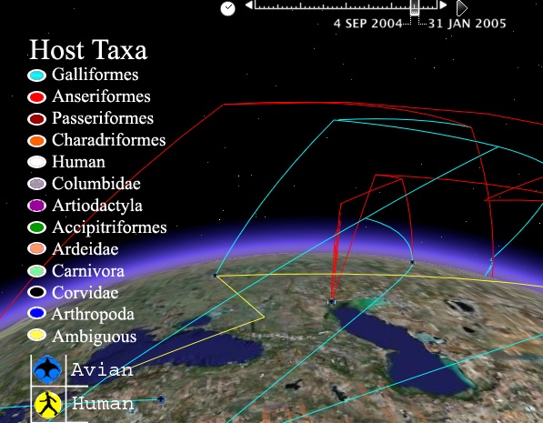
I found this KMZ file the other night. It’s really the greatest Google Earth file I’ve ever seen. It’s tracking bird flu but it’s doing it through, time, space and evolution. It creates a three dimensional representation of the changing aspects of the virus as it moves from carrier to carrier and place to place. […]
ITRT Summer Camp – VSTE
Hey there VSTE ITRTs! Here are links to the resources used in today’s Google Earth/Maps, GPS session. I tried to cull things down a little bit to keep it from being overwhelming. If you want to check out all the links for Google Earth feel free to browse my del.icio.us account. There’s lot more stuff […]
Google Earth – Proof of Concept Stuff

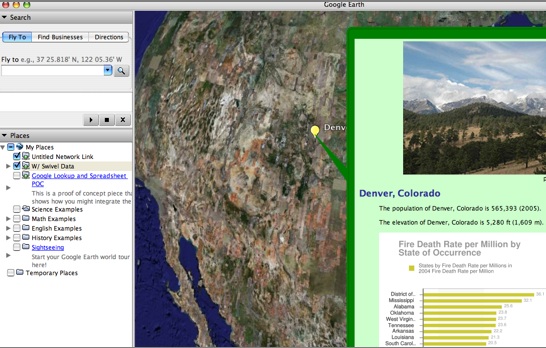
A while back I posted about using GoogleLookup to get data quickly and easily to make and put into Google Earth via Google Spreadsheets. The example file is at http://spreadsheets.google.com/pub?key=pGAYO0Q5WpT8_Rsss6Uw2LQ&output=txt&gid=2&range=a1. It’s a network link. In Google Earth- click Add– Network Link and paste the URL into the Link box. Here’s some information on how to […]
Edubloggercon 2007 Google Earth Session
This branched out into Google Maps, Sketchup and even Swivel. I heard about some great projects being done by 4th and 5th graders using sketchup to create Incan (or Mayan?) ruins and then putting them in Google Earth. I’m really interested in seeing the examples but don’t have a link yet. The most interesting part […]
Whirligig MyMap Evolution Continues
So I’ve added a lot more to the Whirligig map since last time. It turned out to be an awesome choice for this project. Talk about a project that requires a close reading! I spent more time with this short book than I care to admit to. Almost everything in the Whirligig was accurate. It’s […]
Whirligig on MyMaps

I’m working on do something similar to the awesome work over at Google Lit Trips using Google’s myMaps. The novel is Whirligig by Paul Fleischman- very powerful book that’s a quick read. It’s a great novel for this type of project (fiction but almost all real locations). The main character travels to the four corners […]
“My Maps” from Google (an actual example)

I figured after being so gushy about the My Maps option from Google I ought to make a good example. So here is a good start on a territorial acquisition map of the United States of America. I did it free hand based on a number of different maps I found on wikipedia and a […]