This branched out into Google Maps, Sketchup and even Swivel. I heard about some great projects being done by 4th and 5th graders using sketchup to create Incan (or Mayan?) ruins and then putting them in Google Earth. I’m really interested in seeing the examples but don’t have a link yet. The most interesting part […]
Tag: Online Tool
Whirligig MyMap Evolution Continues
So I’ve added a lot more to the Whirligig map since last time. It turned out to be an awesome choice for this project. Talk about a project that requires a close reading! I spent more time with this short book than I care to admit to. Almost everything in the Whirligig was accurate. It’s […]
Yet Another Reason Your Filter is Useless (or neat trick to post to jaiku, wordpress or twitter)

The first part of this post is actually useful. The second part is just me venting about the wrong application of time and energy that is, all too often, school filtering. So I started using Jaiku (like Twitter but with the ability to aggregate all your feeds and a few other neat tricks). Jaiku was […]
Seal Generator

Click and create official looking seals (no bad puns please) of various sorts. It’s easy, quick and fun. You can also order them on magnets which could make for some fun games and ways to decorate your classroom (or house). You can have a lot of fun with this in History and English for sure. […]
Flags and Pie Charts
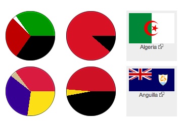
This might be the visual link some students need to start seeing how pie charts reflect real data and it’s not a bad way to get some exposure to the flags of other nations. Basically, the pie chart is shown with the proportional slices for the colors of the flag. You click on the pie […]
Google Timeline
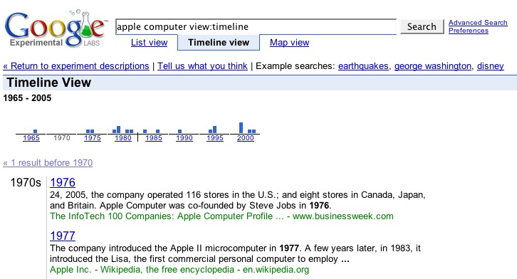
A really amazing looking tool from Google with some interesting educational potential. It’s worth checking out. Found via Digg. […]
“My Maps” from Google (an actual example)

I figured after being so gushy about the My Maps option from Google I ought to make a good example. So here is a good start on a territorial acquisition map of the United States of America. I did it free hand based on a number of different maps I found on wikipedia and a […]
Personal Google Maps
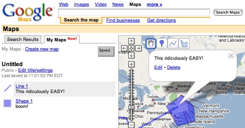
Google now lets you create online annotated maps with amazingly simple tools. You can add info windows (with html), plot lines and add polygons. It really is the easiest thing imagineable. Go there and try it. This example map has absolutely no point. I just made it on the fly to prove to myself how […]
Visualize Census Data with Social Explorer

Social Explorer lets you create easy displays of census data. It also has a built-in slide show generator and a report generator. via Lifehacker […]
Create an rss feed with magic
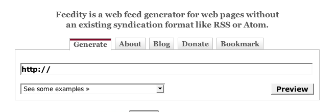
Ok, not magic, but with Feedity. From time to time I come across a website I would love to get updated content from, but the site doesn’t offer a feed. This has frustrated me in the past, but not anymore! Punch in the URL and wahh-laa (or Abracadabra), you have a dynamic feed. via Lifehack […]